@pyxorium.com/3mzvmj4tnhm2e
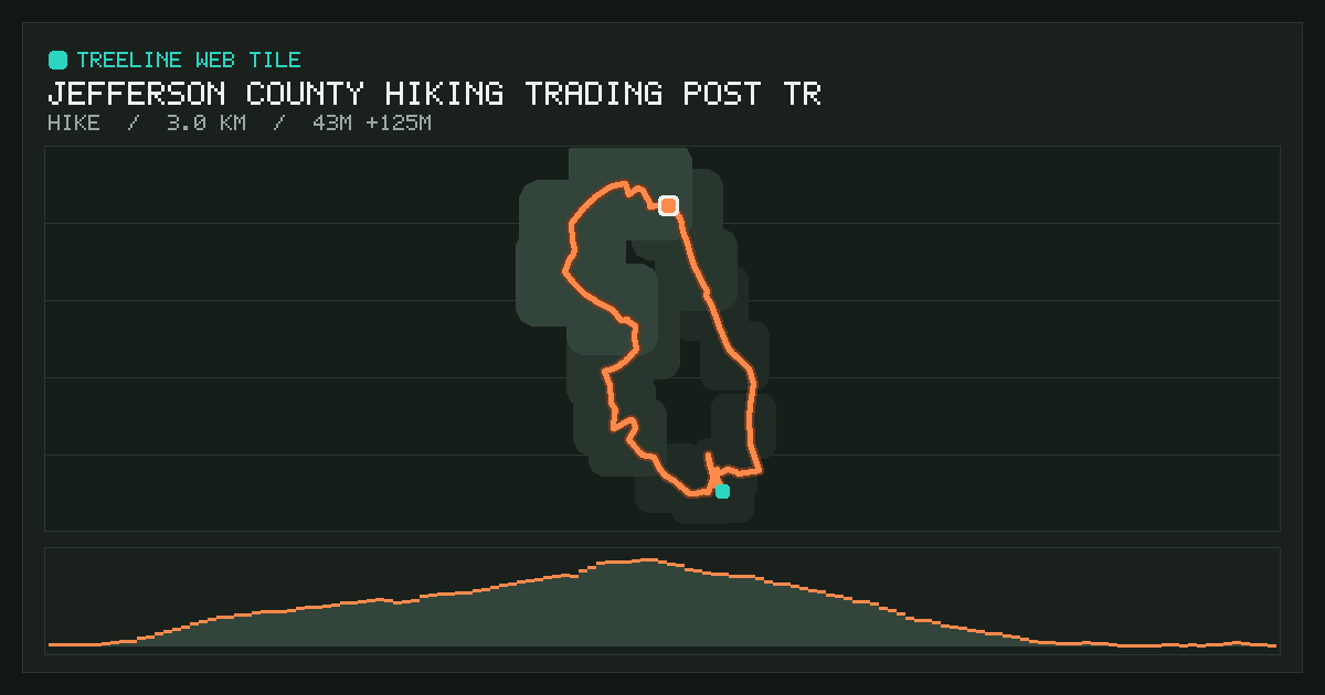
Jefferson County Hiking Trading Post Trail
Loading the tile…
Interactive replay from Nov 6, 2026: 3.0 km in 43 min. Route, elevation and live stats. The 3D view draws relief interpolated from the route’s own elevations, not real terrain. Made with Treeline.

Copy at:// link View record ↗ JSON Publish a new version
- Short ID
@pyxorium.com/3mzvmj4tnhm2e- AT URI
at://did:plc:rqbqpaaluty5v47jwciowpik/ing.dasl.masl/3mzvmj4tnhm2e- Size
- 720 × 520
- Resources
- 6 files, 156 KB
- Published
- Indexed
- Manifest CID
bafyreieqim7feeco656w73mindpx7ktr5nkxfvrt3qltviujwakxv2ute4- Record CID
bafyreidfiy22k5pc2h4gkgawqslxperqkcxnkqwdfconheay6ec6tffzqa
Screenshots

/icon.svg
Resources
| Path | Type | Size | CID |
|---|---|---|---|
/content-security-policy: default-src 'self' blob: data:; script-src 'self' blob: data: 'unsafe-inline' 'wasm-unsafe-eval'; script-src-attr 'none'; style-src 'self' blob: data: 'unsafe-inline'; form-action 'none'; manifest-src 'none'; object-src 'none'; base-uri 'none'; | text/html | 78 KB | bafkreibkg6hvercryb2l3bgvuho2dc25wpjcaz3uxeggylbpndmp3ul2h4 |
/activity.json | application/json | 31 KB | bafkreif42k2sbckgs57ced72hse5xaao5f5u2snlkuxe2wilcvnkxzc4bi |
/DATA.md | text/markdown | 3.2 KB | bafkreifliyenc7t73lgynvzyppbxbopddqjkzqaqwevplls4qtfw6jlcyy |
/icon.svg | image/svg+xml | 906 B | bafkreiguzdx2z7tknrxno5j3llf4xawiwfxnbvatekxqzeuwilfnbmj6xq |
/screenshot.png | image/png | 13 KB | bafkreifqslvmjmjh65spsnb4yvwox4xpcinweuuvi27ns67diga4yrumau |
/terrain.jpg | image/jpeg | 30 KB | bafkreiaekyn55w5usedby33jj2r67jnk2r2oezhnboinuxl6vcrebvoow4 |
Raw record
{
  "$type": "ing.dasl.masl",
  "activityUri": "at://did:plc:rqbqpaaluty5v47jwciowpik/world.treeline.activity.record/3mzoxfovova2b",
  "cid": "bafyreieqim7feeco656w73mindpx7ktr5nkxfvrt3qltviujwakxv2ute4",
  "createdAt": "2026-11-09T19:04:10.618Z",
  "tile": {
    "activityUri": "at://did:plc:rqbqpaaluty5v47jwciowpik/world.treeline.activity.record/3mzoxfovova2b",
    "categories": [
      "fitness",
      "maps"
    ],
    "description": "Interactive replay from Nov 6, 2026: 3.0 km in 43 min. Route, elevation and live stats. The 3D view draws relief interpolated from the route’s own elevations, not real terrain. Made with Treeline.",
    "generator": "Treeline",
    "icons": [
      {
        "src": "/icon.svg"
      }
    ],
    "name": "Jefferson County Hiking Trading Post Trail",
    "resources": {
      "/": {
        "content-security-policy": "default-src 'self' blob: data:; script-src 'self' blob: data: 'unsafe-inline' 'wasm-unsafe-eval'; script-src-attr 'none'; style-src 'self' blob: data: 'unsafe-inline'; form-action 'none'; manifest-src 'none'; object-src 'none'; base-uri 'none';",
        "content-type": "text/html",
        "src": {
          "$type": "blob",
          "ref": {
            "$link": "bafkreibkg6hvercryb2l3bgvuho2dc25wpjcaz3uxeggylbpndmp3ul2h4"
          },
          "mimeType": "application/octet-stream",
          "size": 80273
        }
      },
      "/DATA.md": {
        "content-type": "text/markdown",
        "src": {
          "$type": "blob",
          "ref": {
            "$link": "bafkreifliyenc7t73lgynvzyppbxbopddqjkzqaqwevplls4qtfw6jlcyy"
          },
          "mimeType": "application/octet-stream",
          "size": 3256
        }
      },
      "/activity.json": {
        "content-type": "application/json",
        "src": {
          "$type": "blob",
          "ref": {
            "$link": "bafkreif42k2sbckgs57ced72hse5xaao5f5u2snlkuxe2wilcvnkxzc4bi"
          },
          "mimeType": "application/octet-stream",
          "size": 31290
        }
      },
      "/icon.svg": {
        "content-type": "image/svg+xml",
        "src": {
          "$type": "blob",
          "ref": {
            "$link": "bafkreiguzdx2z7tknrxno5j3llf4xawiwfxnbvatekxqzeuwilfnbmj6xq"
          },
          "mimeType": "application/octet-stream",
          "size": 906
        }
      },
      "/screenshot.png": {
        "content-type": "image/png",
        "src": {
          "$type": "blob",
          "ref": {
            "$link": "bafkreifqslvmjmjh65spsnb4yvwox4xpcinweuuvi27ns67diga4yrumau"
          },
          "mimeType": "image/png",
          "size": 13630
        }
      },
      "/terrain.jpg": {
        "content-type": "image/jpeg",
        "src": {
          "$type": "blob",
          "ref": {
            "$link": "bafkreiaekyn55w5usedby33jj2r67jnk2r2oezhnboinuxl6vcrebvoow4"
          },
          "mimeType": "image/jpeg",
          "size": 30559
        }
      }
    },
    "screenshots": [
      {
        "sizes": "1200x630",
        "src": "/screenshot.png",
        "type": "image/png"
      }
    ],
    "sizing": {
      "height": 520,
      "width": 720
    }
  }
}