@pyxorium.com/3myj3zmgqla2h
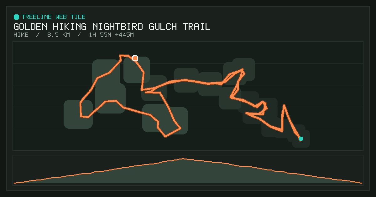
Golden Hiking Nightbird Gulch Trail
Loading the tile…
Interactive replay from Oct 21, 2026: 8.5 km in 1 h 55 min. Route, elevation and live stats. The 3D view features real Open DEM terrain elevation. Made with Treeline.

View record ↗ JSON Publish a new version
- Short ID
@pyxorium.com/3myj3zmgqla2h- AT URI
at://did:plc:rqbqpaaluty5v47jwciowpik/ing.dasl.masl/3myj3zmgqla2h- Size
- 720 × 520
- Resources
- 5 files, 146 KB
- Published
- Indexed
- Manifest CID
bafyreiag4o3y7d4ixpv3vo5htv7zl67qkczpvlod2nw4zldd2mqx6naqnm- Record CID
bafyreiglsnp2bavoc2wri6w2ixsdsj44y2jtbtnop6ncdr66ke5i6tcrqa
Screenshots

/icon.svg
Resources
| Path | Type | Size | CID |
|---|---|---|---|
/content-security-policy: default-src 'self' blob: data:; script-src 'self' blob: data: 'unsafe-inline' 'wasm-unsafe-eval'; script-src-attr 'none'; style-src 'self' blob: data: 'unsafe-inline'; form-action 'none'; manifest-src 'none'; object-src 'none'; base-uri 'none'; | text/html | 85 KB | bafkreibvizbkwzp3svl4y5iafrvltvza7azmnlg4ujcovcwxrp2pugkdde |
/activity.json | application/json | 39 KB | bafkreiel7zx4lq3p3njlq5awy247zi2b467yagz24b4e5sxj34riwjiehq |
/DATA.md | text/markdown | 4.3 KB | bafkreifj7yl7zup34rvfdcxqfqljzdrrvtmceoatkp5wezzjg5mk3isr3q |
/icon.svg | image/svg+xml | 836 B | bafkreigs5fiybcariexf7am62k5d7xznedtc56pfqav2lprzlodatmzzay |
/screenshot.png | image/png | 16 KB | bafkreidpc2w6ksvjlcgyyqay724fbq3gbmtbrwfpg5i3ihd3cb7gnpf7bm |
Raw record
{
  "$type": "ing.dasl.masl",
  "activityUri": "at://did:plc:rqbqpaaluty5v47jwciowpik/world.treeline.activity.record/3mygj33hg5a2h",
  "cid": "bafyreiag4o3y7d4ixpv3vo5htv7zl67qkczpvlod2nw4zldd2mqx6naqnm",
  "createdAt": "2026-10-23T02:11:22.880Z",
  "tile": {
    "activityUri": "at://did:plc:rqbqpaaluty5v47jwciowpik/world.treeline.activity.record/3mygj33hg5a2h",
    "categories": [
      "fitness",
      "maps"
    ],
    "description": "Interactive replay from Oct 21, 2026: 8.5 km in 1 h 55 min. Route, elevation and live stats. The 3D view features real Open DEM terrain elevation. Made with Treeline.",
    "generator": "Treeline",
    "icons": [
      {
        "src": "/icon.svg"
      }
    ],
    "name": "Golden Hiking Nightbird Gulch Trail",
    "resources": {
      "/": {
        "content-security-policy": "default-src 'self' blob: data:; script-src 'self' blob: data: 'unsafe-inline' 'wasm-unsafe-eval'; script-src-attr 'none'; style-src 'self' blob: data: 'unsafe-inline'; form-action 'none'; manifest-src 'none'; object-src 'none'; base-uri 'none';",
        "content-type": "text/html",
        "src": {
          "$type": "blob",
          "ref": {
            "$link": "bafkreibvizbkwzp3svl4y5iafrvltvza7azmnlg4ujcovcwxrp2pugkdde"
          },
          "mimeType": "application/octet-stream",
          "size": 87117
        }
      },
      "/DATA.md": {
        "content-type": "text/markdown",
        "src": {
          "$type": "blob",
          "ref": {
            "$link": "bafkreifj7yl7zup34rvfdcxqfqljzdrrvtmceoatkp5wezzjg5mk3isr3q"
          },
          "mimeType": "application/octet-stream",
          "size": 4358
        }
      },
      "/activity.json": {
        "content-type": "application/json",
        "src": {
          "$type": "blob",
          "ref": {
            "$link": "bafkreiel7zx4lq3p3njlq5awy247zi2b467yagz24b4e5sxj34riwjiehq"
          },
          "mimeType": "application/octet-stream",
          "size": 40124
        }
      },
      "/icon.svg": {
        "content-type": "image/svg+xml",
        "src": {
          "$type": "blob",
          "ref": {
            "$link": "bafkreigs5fiybcariexf7am62k5d7xznedtc56pfqav2lprzlodatmzzay"
          },
          "mimeType": "application/octet-stream",
          "size": 836
        }
      },
      "/screenshot.png": {
        "content-type": "image/png",
        "src": {
          "$type": "blob",
          "ref": {
            "$link": "bafkreidpc2w6ksvjlcgyyqay724fbq3gbmtbrwfpg5i3ihd3cb7gnpf7bm"
          },
          "mimeType": "image/png",
          "size": 16675
        }
      }
    },
    "screenshots": [
      {
        "sizes": "1200x630",
        "src": "/screenshot.png",
        "type": "image/png"
      }
    ],
    "sizing": {
      "height": 520,
      "width": 720
    }
  }
}